
The Balkans are being reconnected through asphalt and railways

How roads, railways, ports and border points are reshaping the economic and strategic map of South-Eastern Europe, as BGNES writes
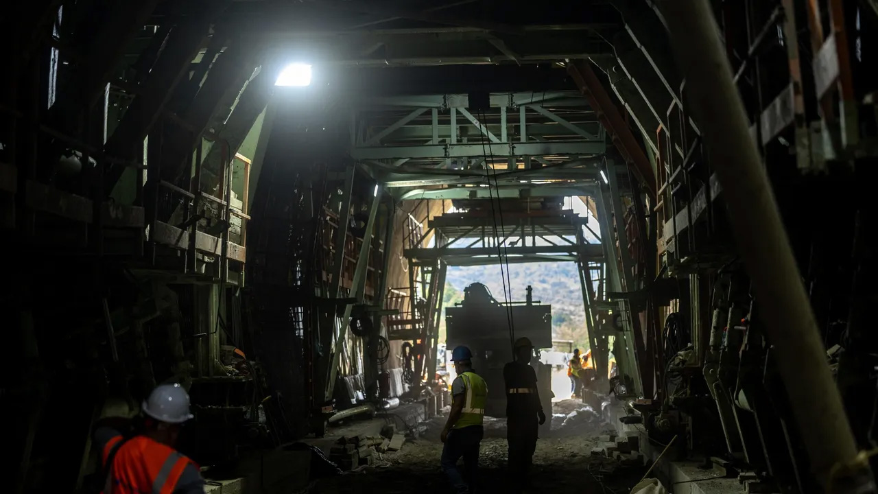
The start of construction of a 10.5-kilometre motorway between Skopje and the border with Kosovo is, at first glance, a relatively modest infrastructure story. The project is short, technically difficult and important at national level, but it is only a small part of a much larger transformation.
Its real importance lies in what it shows about the Balkans as a whole. Across the peninsula, governments, the European Union, NATO, international financial institutions and outside powers are investing in corridors linking the Adriatic Sea, the Aegean Sea and the Black Sea with the Danube basin and Central Europe. Old transport corridors are being modernised, missing links are being completed and ports are competing for access to markets far beyond their traditional service areas.
The region is gradually moving away from a map dominated by one or two north-south corridors. In their place a network of competing and complementary axes is emerging: Corridor X through Serbia, North Macedonia and Greece; Corridor VIII between the Adriatic and the Black Sea; Corridor Vc through Bosnia and Herzegovina; the Danube waterway; the Adriatic-Ionian corridor; the links between Kosovo, Albania and Serbia; and the transport system developing between the Aegean, Bulgaria, Romania and the Black Sea.
These projects are not simply about shortening travel time. They concern trade, industrial geography, port competition, energy security, European integration and military mobility. They also determine which Balkan capitals will become transport hubs and which regions risk remaining on the periphery.
A peninsula shaped by geography
The Balkans have always been difficult to connect. Mountain ranges divide relatively small national markets. Rivers often cross political borders. The coastline is long but fragmented, while many of the largest cities and industrial centres lie inland. Border regimes add another layer of delay to an already complicated geography.
Historically, transport infrastructure developed along a limited number of natural crossings. The Morava and Vardar valleys created the most important north-south corridor between the Danube basin and the Aegean. The Danube itself provided an east-west waterway. Coastal roads linked ports and tourist centres, while mountainous inland areas remained harder and more expensive to cross.
Political history reinforced this pattern. Infrastructure was often built to link provincial territories with imperial or national capitals, not to integrate the peninsula as a single economic space. The result is a region where some main corridors are already consolidated, while others remain unfinished decades after they were first proposed.
Today, the strategic objective is not simply completing individual motorways. The aim is building a system where roads, railways, rivers, ports and border points work together. A motorway ending at an inefficient border point is not a corridor. A modern port without a reliable railway link to inland areas is not a gateway. A new tunnel has limited value if the connecting lines on both sides remain outdated. Competition is therefore no longer about who can build the most kilometres. The question is who can create the most reliable transport service, from the port crane to the industrial terminal.
Corridor X: The consolidated north-south axis
Its main route links Central Europe with Zagreb, Belgrade, Niš, Skopje and Thessaloniki. Branches create links towards Budapest, Sofia and other regional centres. Its strength comes from geography. The Morava-Vardar route is the most natural land crossing between the Danube basin and the Aegean Sea. It crosses several national borders, but avoids some of the most difficult mountain barriers in other parts of the peninsula.
Corridor X also benefits from decades of accumulated economic activity. The largest cities along the route already have logistics centres, railway hubs, industrial zones, customs infrastructure and established transport companies. Belgrade is the region’s main inland hub. It links Central Europe, the Danube, the Western Balkans and the corridors towards the Adriatic and Aegean seas. Niš distributes traffic towards Skopje, Sofia and Kosovo. Skopje links the north-south axis with the east-west direction of Corridor VIII and with the road towards Pristina. Thessaloniki provides access to one of the region’s most important ports and to the wider maritime corridors of the Eastern Mediterranean.
Corridor X is also part of the economic logic behind Chinese investment in the Port of Piraeus and in the railway links heading north through the Balkans. Goods arriving from Asia through the Suez Canal can enter Europe through Greek ports and continue towards Central European markets.
However, the corridor’s railway potential remains below its theoretical capacity. Different speeds, outdated signalling systems, border delays and unfinished modernisation reduce the competitiveness of rail freight. For this reason, road transport carries a large share of traffic, despite driver shortages, fuel costs, congestion and environmental pressures.
The dominance of Corridor X is also a strategic weakness. Too much north-south traffic depends on a single valley system and a limited number of border points. An accident, natural disaster, long reconstruction project or political dispute can affect the whole chain. The objective of other Balkan corridors should not be to replace Corridor X. Their value lies in offering alternatives, reducing dependence on a single route and creating a more resilient regional network.

Corridor VIII: The unfinished Adriatic-Black Sea link
If Corridor X is the consolidated north-south axis, Corridor VIII is the great, still unfinished east-west project. The traditional route starts from the Albanian ports of Durrës and Vlora, passes through Tirana, Elbasan, the Ohrid region and Skopje, enters Bulgaria and continues through Sofia towards Burgas and Varna.
Its strategic importance is obvious. It would create a direct land link between the Adriatic and the Black Sea, through the central part of the Balkans. The difficulties are just as obvious. The route must cross some of the peninsula’s most complicated terrain. It also depends on synchronised investment in Albania, North Macedonia and Bulgaria. Road segments are progressing at different rates, but the decisive challenge remains the railway.
A genuine trans-Balkan corridor requires an uninterrupted railway link between the Adriatic ports and Bulgaria. Large parts of this route remain unfinished, under reconstruction or at the planning stage. The missing railway link between Bulgaria and North Macedonia has become the most politically visible part of the project. The planned cross-border tunnel between Gyueshevo and Deve Bair is essential, but it is only one component of a much longer chain. The western section towards Albania is just as important. Without a reliable railway link between Skopje, the Ohrid region and Durrës, Corridor VIII will remain a set of national projects rather than a functional continental corridor.
The corridor’s economic importance goes beyond transit. Durrës can provide access to a wider inland market. Bulgaria’s Black Sea ports can extend their service area further west. Sofia can become a distribution point between the Adriatic, the Danube, Istanbul and the Aegean. At the same time, better links would intensify competition between Durrës, Thessaloniki, Burgas and Varna. Ports would compete not only through tariffs and capacity, but also through the quality of railway links, customs services and logistics terminals.
Corridor VIII has also taken on a military dimension. Italy, Albania, North Macedonia and Bulgaria have politically committed to improving military mobility along the Adriatic-Black Sea direction. The corridor could offer NATO an additional option for moving personnel and equipment towards the eastern flank, complementing routes through Central Europe and Romania. However, the corridor’s military value depends on the same elements that determine its commercial value: sturdy bridges, suitable tunnels, modern railways, secure communications, efficient borders and sufficient terminal capacity.
The Danube: Europe’s strategic waterway through the Balkans
The Danube is sometimes left in the background in discussions dominated by motorways, but it remains one of Europe’s most important transport corridors. It links the industrial regions of Central and Western Europe with Austria, Slovakia, Hungary, Croatia, Serbia, Bulgaria, Romania and the Black Sea. For bulk goods, agricultural products, fuels, construction materials and heavy industrial loads, river transport can be significantly cheaper than road transport.
The Danube also links several of the peninsula’s other transport systems. Belgrade links the river with Corridor X and the Sava basin. Budapest links it with Central Europe’s railway and road networks. Bulgarian and Romanian ports provide access to the Black Sea and the wider maritime system.
The war in Ukraine showed the river’s importance as an alternative export route and as a strategic logistics corridor. But it also exposed its weaknesses. Variable water levels can reduce vessel capacity. Some segments require more frequent intervention to deepen and clear the riverbed. Port infrastructure is uneven, while railway links to river terminals are often insufficient. Climate change makes these problems more serious. Longer periods of low water can reduce the reliability of river transport at precisely a moment when Europe needs more alternatives for heavy freight.
For this reason, the Danube must be understood as more than a navigation channel. Its future depends on modern ports, railway access, digital traffic management, adaptation to climate change and coordination among the states along the river.
Corridor Vc: A national integration project of regional importance
Corridor Vc links Central Europe with eastern Croatia, Sarajevo and the port of Ploče. Its most difficult and politically most important section is in Bosnia and Herzegovina, where the motorway must pass through complicated mountainous terrain.
For Bosnia and Herzegovina, Corridor Vc is not simply a transit road. It is an instrument of internal economic integration. The motorway can improve links between Sarajevo, industrial centres, regional cities and the Adriatic coast. It can reduce the isolation of inland areas and give the country more efficient access to European markets.
Its construction also illustrates the institutional difficulties affecting many infrastructure projects in the Balkans. Different levels of government must cooperate on planning, expropriations, financing and environmental procedures. Mountain sections require expensive tunnels and bridges. Individual segments can be completed long before the whole corridor becomes functional.
Despite these difficulties, Corridor Vc can radically change Bosnia and Herzegovina’s economic geography. It would strengthen Ploče’s position as the country’s natural maritime gateway and integrate the central Balkans more closely with Croatia, Hungary and the wider EU market.
Kosovo, Albania and the developing Route 6-Route 7 system
The new Skopje-Bllacë motorway is part of another important transport system linking North Macedonia, Kosovo, Albania and potentially Serbia. Route 6 links Skopje with Pristina. Route 7 links Pristina with Prizren and the Albanian border, providing access towards Durrës. The north-eastern direction towards Merdare could in future link Kosovo more efficiently with Niš and Central Europe.
This system gives Kosovo a strategic position between several larger corridors. In the south, it provides access towards Skopje and Thessaloniki. In the west, it links with Albania and the Adriatic. In the north, it can link with Serbia and the Danube basin.
The economic logic is strong, but the political conditions are more complicated. The full value of the northern road depends on relations between Belgrade and Pristina, the border regime and the completion of the missing motorway segments.
The Albania-Kosovo link is already much more developed. As roads towards Skopje improve, Durrës can expand its service area beyond Albania and Kosovo, towards North Macedonia and potentially further east. This is why a short project such as Skopje-Bllacë can matter without being at the centre of the regional story. It closes a gap between networks that are already taking shape.
The Adriatic-Ionian axis
The Adriatic-Ionian motorway aims to link Trieste and the Croatian coast with Montenegro, Albania and Greece. Its economic profile differs from that of Corridors VIII and X. It is more oriented towards movement along the coast, tourism, ports and links between relatively dispersed urban centres.
For Montenegro and Albania, this road can reduce the isolation of coastal regions and improve access to ports, airports and tourist destinations. For Croatia and Greece, it would create a more continuous coastal transport system and offer a north-south alternative outside the Balkan interior. The road could also strengthen links between northern Adriatic ports and the growing port infrastructure in Albania and Greece.
Its weakness is the limited link between some coastal areas and inland industrial markets. A coastal motorway can improve tourism and passenger mobility, but the wider economic impact depends on connecting roads, railways and logistics centres leading inland.
The Black Sea-Aegean axis
A new transport system is also developing between Greece, Bulgaria and Romania. Its aim is to link the Aegean ports, Thessaloniki and Alexandroupolis, with Sofia, the Danube, Bucharest, Constanța, Burgas and Varna.
Several parallel corridors are being discussed and developed. One passes through Athens, Thessaloniki, Kulata, Sofia and Vidin towards Romania. Another links Thessaloniki or Alexandroupolis with the Bulgarian border, Ruse and Bucharest. A third links Alexandroupolis with Svilengrad, Burgas, Varna and Constanța.
The strategic objective is creating alternatives. A system of parallel railways, roads, ports and bridges would reduce dependence on individual border points and on the maritime crossing through the Bosphorus.
For Bulgaria, this opportunity is particularly important. The country can become the main land bridge between the Aegean, Black Sea and Danube systems. For Greece, the corridors would expand the northern service area of the ports of Thessaloniki and Alexandroupolis. For Romania, they would strengthen the link between Constanța, Central Europe and the Eastern Mediterranean.
The military importance is also clear. These corridors would support movement between Aegean ports and NATO’s eastern flank, while offering alternatives to overloaded or vulnerable transport points.
Ports competing for the Balkan hinterland
Competition between Balkan corridors is also competition between ports. Piraeus has become a main gateway for Asian goods entering Europe through the Suez Canal. Its strategic value depends on the railway and road routes continuing north through Greece and the central Balkans. Thessaloniki has a strong geographical position as the traditional maritime outlet for North Macedonia, southern Serbia, Kosovo and parts of Bulgaria. Durrës is expanding its role as the western gateway for Albania and Kosovo and aims at a wider service area in North Macedonia and beyond. Ploče remains the natural maritime outlet for Bosnia and Herzegovina. Burgas and Varna serve Bulgaria and the Black Sea region, but can also compete for goods from further west if Corridor VIII and the connecting railways are completed. Constanța is one of the region’s largest ports and links the Black Sea with the Danube and Central Europe. Alexandroupolis has gained strategic importance because of energy infrastructure, its military role and possible links with Bulgaria and Romania.
Ports compete not only through their location. They compete through terminal capacity, customs efficiency, railway access, warehousing, digital services, energy infrastructure and the reliability of the whole inland transport chain. A port with a shorter sea route can still lose goods if trains are slow, border crossings are unpredictable or the last segment link is congested. Successful ports will be those that combine maritime capacity with a reliable continental transport network.
Economic value lies in reliability
Governments often present transport projects through length, construction cost and maximum speed. Businesses use other criteria. For an exporter, the most important question is not simply whether a road is shorter. The issue is whether the cargo will arrive at a predictable time. A modern motorway can save 30 minutes of travel, while an inefficient border point can add several hours of uncertainty. A new railway can increase theoretical capacity, while outdated signalling and slow customs procedures prevent operators from using it efficiently.
Reliability determines the size of the market a port, factory or warehouse can serve. A reliable corridor allows companies to reduce inventories, use “just-in-time” production and organise regular deliveries. An unpredictable corridor forces them to hold larger reserves and pay more for insurance, warehousing and alternative transport.
Transport hubs can also create local economic development. Warehouses, cold-storage plants, light manufacturing, repair services and logistics companies tend to concentrate around reliable infrastructure. The benefits are not automatic. Municipalities must provide industrial land, public services, workforce training and local public transport. Otherwise, communities can face noise, pollution and damage to the territory, while economic value passes through them without creating enough local jobs.
Better transport also affects workforce mobility and tourism. Links such as Sarajevo-Ploče, Skopje-Pristina and Sofia-Thessaloniki can expand regional labour markets and make short tourist trips more practical. At the same time, improved access can accelerate migration from weaker regions towards capitals, ports and coastal centres. Infrastructure creates opportunities, but public policy determines where those benefits will concentrate.
Borders remain the most costly obstacles
The Balkans’ physical infrastructure is improving faster than many of its border points. Freight vehicles can still spend hours waiting for customs, police, veterinary and phytosanitary controls. These delays are not simply an annoyance. They function as an additional tax on trade. They increase fuel consumption, reduce the productivity of vehicles and drivers, complicate delivery schedules and force companies to hold larger inventories.
The economic effect of reducing border delays by a few hours can be comparable to reducing a customs tariff. This means new infrastructure must be accompanied by administrative reforms. Border points need sufficient lanes for freight transport, joint documentation, data exchange before arrival, coordinated inspections and real-time performance monitoring. Where political and legal conditions allow, neighbouring countries should carry out joint controls or through a one-stop system. Digital “Green Corridors” have already shown that data exchange can reduce waiting time without waiting for a completely new motorway to be completed.
The most successful corridor will not necessarily be the one with the newest road. It may be the one with the fastest and most predictable border.
The European Union’s geopolitical model
The European Union is the largest external force shaping transport infrastructure in the Balkans. Its influence comes not only from financing, but from the combination of financing, technical standards and regulatory integration. European grants and loans support motorways, railways, bridges, ports and border points. In return, projects are expected to respect common requirements for procurement, environmental protection, safety and interoperability.
This turns infrastructure into an instrument of enlargement. A modern railway built to European standards links a candidate country with the EU before formal membership. A digital customs system establishes common rules before political integration is complete. The revised TEN-T network places the Western Balkans inside Europe’s transport map, instead of treating it as an external and disconnected region.
This is strategically important for both sides. Western Balkan economies gain access to financing and larger markets. The European Union gains more reliable links with Greece, Bulgaria, Romania, Croatia, Hungary and Italy.
The weakness of the European approach is its speed. Project preparation, procurement and environmental procedures can take years. Governments seeking fast and visible results are often tempted by bilateral agreements that promise faster construction. The long-term value of European projects depends on whether higher standards and stronger oversight produce more reliable infrastructure throughout its life cycle.
NATO and the new geography of military mobility
The war in Ukraine changed the strategic meaning of transport infrastructure across Europe. Roads, railways and ports are being reassessed according to their ability to transport military personnel, equipment, fuel and ammunition.
The Balkans occupy an important position between the Adriatic, the Eastern Mediterranean, the Danube and the Black Sea. Corridor X provides a central route from Central Europe towards Greece. Corridor VIII offers a possible link between Italy, the Adriatic and Bulgaria. The Danube can transport heavy loads. Greek, Bulgarian and Romanian roads link Aegean ports with the eastern flank. Adriatic ports offer additional entry points that reduce dependence on the North Sea and Central European corridors.
Military mobility requires more than wide motorways. Bridges must withstand heavy loads. Tunnels must have suitable dimensions. Railways require modern signalling, sufficient train lengths and loading terminals. Border authorities need fast authorisation procedures. Fuel supply, repair capacity, secure communications and alternative routes are just as important.
These investments also benefit the civilian economy. A bridge capable of holding heavy military equipment can also transport industrial machinery. A modern freight terminal can serve both defence logistics and commercial transport. Faster border procedures reduce costs for businesses and armed forces alike. The strongest military corridors will therefore be those supported by a sustainable civilian economy.
China’s transport strategy in the Balkans
China’s infrastructure presence follows the corridor from the port of Piraeus through the central Balkans towards Budapest. The port, the Belgrade-Budapest railway and major road projects in Serbia and Montenegro are the most visible parts of this strategy.
The appeal of the Chinese model lies in fast bilateral negotiations and the combination of financing, construction and political agreement. For Balkan governments, this can seem faster and simpler than the European process. The risks include debt exposure, limited transparency, dependence on foreign contractors and projects that do not always fit the wider regional network. However, Chinese financing gives governments alternatives and more negotiating power. It also shows that control over ports and inland transport routes has become part of a broader geopolitical competition.
Turkey and the south-eastern gateway
Turkey is another important factor in the Balkan transport system. Roads through Istanbul and Thrace link South-Eastern Europe with the Turkish economy, the Caucasus, the Middle East and developing trade corridors through the Caspian Sea and Central Asia.
For Bulgaria and Greece, this creates both opportunity and pressure. Traffic from Turkey can support logistics, production and port activity, but can also create congestion at border points. The Bosphorus remains a critical maritime crossing, while Istanbul is one of the largest transport and economic centres near the Balkans. Developing land links between the Aegean and the Black Sea can offer alternatives, but will not reduce Turkey’s importance. Instead, the region is likely to develop a more complex system, where Turkish, European, Adriatic and Black Sea corridors intertwine.
Balkan states have their own strategies
The countries of the region are not passive parts of a race between Brussels, Washington, Beijing and Ankara. Each is using infrastructure to pursue its own national interests. Serbia aims to maintain its position as the central land hub of the Western Balkans. Greece is strengthening Piraeus, Thessaloniki and Alexandroupolis as competing gateways. Albania wants Durrës and Porto Romano to serve markets beyond its national borders. Croatia is integrating its ports and road network more closely with Central Europe. Bosnia and Herzegovina sees Corridor Vc as an instrument for internal cohesion and access to the sea. North Macedonia aims to use its central position to link several regional directions. Kosovo seeks reliable access to the Adriatic, the Aegean and Central Europe. Bulgaria aims to become the hub between the Black Sea, the Danube, the Aegean, the Adriatic and corridors towards Turkey. Romania is strengthening Constanța and the Lower Danube, while improving links with Central Europe and Greece.
The final transport map of the Balkans will be the result of these overlapping national strategies. No single corridor will dominate every category of traffic. Different routes will compete for containers, bulk goods, energy, passengers, tourism and military logistics.
Bulgaria’s strategic choice
Bulgaria occupies one of the most important geographical positions in the emerging network. It links the Danube with the Aegean and Black seas. It lies between Central Europe, Turkey and the Western Balkans. It is also the eastern edge of Corridor VIII.
However, geography alone does not guarantee economic value. Bulgaria’s opportunity depends on completing the missing railway links towards North Macedonia, improving lines towards Serbia and Turkey, modernising access towards Burgas and Varna and increasing the capacity of crossings over the Danube. The country also needs efficient intermodal terminals and better links between ports, industrial zones and railway corridors.
A strategy focused only on motorways would exploit only part of the potential. For mass freight transport, railways and river transport are essential. For port competition, last-segment access and terminal efficiency are decisive. For military mobility, bridge capacity and alternative routes matter as much as motorway speed.
Bulgaria’s most valuable role is not simply to serve as transit territory. It can become a distribution and logistics centre where cargoes are transferred between the Adriatic, Aegean, Black Sea and Danube systems. This requires coordinated investment, not isolated projects.
The risk of building an archipelago
The greatest risk is that the Balkans build an impressive archipelago of modern segments, without creating a functional network. New tunnels can lead towards old single-track railways. Modern motorways can end at slow border points. Large ports can lack suitable links to the interior. Neighbouring countries can complete their segments according to different deadlines and incompatible priorities.
Political leaders tend to measure progress by kilometres of completed roads. Transport companies measure it by predictable hours and days. This difference is essential. A corridor becomes economically valuable only when its weakest link is improved. Sometimes that link is a mountain tunnel. In other cases it is a railway station, a customs procedure, a bridge, a port terminal or a bilateral political dispute.
Maintenance is another major risk. New infrastructure deteriorates quickly without sustainable budgets, asset management and adaptation to the climate. The Balkans’ infrastructure problem has often been presented as a lack of construction. In reality, it is also a problem of maintenance, coordination and long-term management.
From corridors towards a Balkan network
The most successful future for the region is not one where Corridor VIII defeats Corridor X or where Durrës defeats Thessaloniki. It is one where several corridors can compete, while simultaneously supporting each other in case of disruptions. If a railway closes, goods should be able to be redirected through another port or corridor. If low water limits navigation on the Danube, railway capacity should offer an alternative. If a border becomes congested, the system should have another reliable crossing point.
Such redundancy of capacity can seem inefficient when every corridor functions normally. During a crisis, it becomes an economic and strategic asset. In peacetime, a denser network reduces logistics risk, expands markets and attracts investment. In wartime or during a natural disaster, it enables governments and companies to redirect people, goods, energy and military resources.
The motorway between Skopje and Bllacë should be understood, for this reason, as a small sign of a much larger change. The Balkans are not simply building more roads. They are reshaping their economic geography. The decisive question is no longer where a single corridor begins and ends. The question is whether the Adriatic, Aegean, Black Sea and Danube systems can be linked through several reliable corridors — and whether the countries of the region can coordinate infrastructure, borders and political decisions well enough to make this network functional. | BGNES


Komentet
Bëhu i pari që komenton!
Lini një Koment të Ri
Për t'u përgjigjur një komenti specifik, kliko butonin 💬 Përgjigju poshtë atij komenti.